Wednesday, July 23, 2014

Esri 2014 Business Summit & User Conference Highlights


Simon Thompson opens the Sunday Business Summit
The 2014 Esri Business Summit and the annual User’s Conference was one of the best ever.  And for Banking, it was truly a breakthrough year, with many of the top banks in the U.S. and throughout the world in attendance.

Sunday, July 13 Business Summit Highlights

Jon Voorhees, SVP of Retail Distribution at Bank of America - and an old RPM friend and Northridge colleague - gave one of the most informative, entertaining, actionable, and data-centric presentations ever given at the Summit (OK, so he's our pal, so what.).  Jon leads the retail distribution execution team at B of A, where he’s responsible for the execution of all retail distribution programs impacting nearly 9,000 banking center and ATM locations.  Jon’s group consists of about 100 users nationwide, predominantly working from home to help re-configure branch network locations and sites.

Jon suggests what branches will become
Jon has been a leader in the effort to resize and transform the Bank’s large distribution network, and what he had to say about where branch banking is headed was transformative.  Jon described – or rather, proscribed – that there will be “no single format for the Bank of the Future”.  Jon defined several of the branch types that the Bank will be creating.

Flagship.  Each of the Bank’s Top 15 markets will have a Flagship branch, a contemporary full service approach staffed with full time specialists.
Enhanced Banking Centers.  These branches will have 2 or more specialist full-time, but will also feature and rely on a good deal of digitally delivered content.
Standard Banking Centers.  These are the traditional branches, with specialist coverage defined by market needs and usage.
Express Centers.  The Express Centers will have no tellers – transactions will be strictly automated, allowing the branch to concentrate on sales and service, again fine-tuned to the market.
Remote ATMs and ATAs.  The Bank appears to be among the most successful at placing off-premise machines, and adding ATM assist technology that incorporates Teller-on-Demand, including the ability to be served on-demand in Spanish.

Jon also discussed some of the innovations inside, like Teller Assist – and the Bank’s successes with reconfiguring branches.

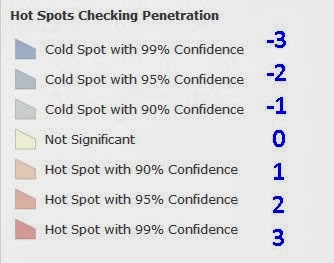
Carlous had great slides!
What does this have to do with GIS?  Well, Jon’s colleague Carlous Brown, the Vice President for Distribution Market Planning at Bank of America for the Southeast and California, spoke to this quite eloquently in the following presentation.  Carlous’ talk, “Thinking Spatially at Bank of America”, further elaborated upon the change in branches from “high volume to high value”.  The future requires fewer physical locations, but greatly enhanced, convenient access to specialists.  Carlous described the inherent challenges and the need for retrofitting, downsizing, relocation, etc. and the key role that spatial analysis plays, as the bank moves towards a smaller physical footprint (Jon mentioned a reduction to under 5,000 branches by year-end) and a hub and spoke system that more efficiently distributes resources.

In fact, Carlous mentioned spatial analysis as a key underpinning of most everything that the Bank is doing.  As an underpinning to strategic distribution planning, he described “Controllable” (where are our current and prospective locations, where are we saturated, etc.) and “Non Controllable” factors (demography, regulatory, etc.), and described in detail all of the key data inputs to distribution strategy.
  • Site-Specific, such as location, usage, profitability
  • Demographics, block group stats on population, growth, daytime population, income
  • Customer locations, stripped of personal identifiers in the GIS
  • Regulatory – low and moderate income and minority designated areas
  • Competition – location, deposits, open date
  • Retail – shopping center and key retailer locations
  • Physical geography – streets, railroads, water features, topography, etc.
Carlous also described how seminal GIS has become to virtually everything the Bank plans and does, supporting all of the following processes:
  • Market investment prioritization
  • Branch & remote ATM planning
  • Regulatory compliance
  • New branch forecasting
  • Customer spotting
  • Attrition-retention modeling
  • M&A analysis
  • Risk mitigation
  • Asset management
  • Logistics
  • Real estate appraisal
  • Commercial RFP response
  • Investor relations
It’s easy to see why we thought this was one of the best of all Summit presentations in the dozen or so years that the Summit has been held.  When online resources become available from the Summit, we’ll pass all of the links along.

Monday, July 14 UC Plenary Highlights

Even before the Plenary began, RPM’s new Unbanked map and dataset from the new Living Atlas of the World was prominently featured as one of the slides on the giant central screen, one of 7 positioned for viewing by the some 16,000 folks in attendance.

Esri has already made the Plenary videos available, and you can find them all at

Here are just a couple of the major “Coming Attractions” that we heard about on Monday.

ArcGIS Pro.  The brand-new, Excel-like ArcGIS Pro will ultimately be the replacement for the ArcGIS Desktop.  It’s 64 bit, and multithreaded, so it will be much faster, even when you have other apps open (like Office).  Pro also features the ability to save multiple layouts of a single map, so there will be no more proliferation of weighty project files when all you want is a layout.  Labeling is much easier, and better exposed in the ribbon menu.  There is also much better management of the structure and format of tables.  All in all, Pro is really what we’ve wanted all along as business users.  Something that looks and works just like Excel.

GeoPlanner.  GeoPlanner is a new ArcGIS extension that offers a slider-based, very easy-to-use approach to geodesign, providing tools that support all the steps of land-based planning, featuring a complete geo-enabled design workflow that is browser-based. We’re very excited at the possibilities of geodesign in banking. 

For example, a bank could use GeoPlanner to implement strategy and designate which of several types of “branches of the future” each of their current branches will be, based on geodesign – basing the type of branch on its geographic location, the site, and the land use and land characteristics.  In other words, GeoPlanner allows us to specify thresholds for business opportunity, savings v borrowing v transaction business, key demographics, urbanicity, share of wallet etc. to define what branch type will be carved from the former branch structures, dominated by the oversized full service branches configured to do the business of the 20th, not 21st century.

Remembering Roger Tomlinson


Roger Tomlinson, an Officer of the Order of Canada, was the father of GIS, and a mentor to many of us.  Roger passed away in February, and was memorialized at the conclusion of the Plenary and in a special memorial area at the UC. 

Roger’s patience and encouragement of adults and kids alike who are brand new to GIS is legendary.  It's an example for us all, as we seek to make GIS more valuable for our companies and clients, internal and ultimate employees, and customers, communities and neighborhoods.

The memorial featured this note of thanks to Roger, from a person who herself is now a GIS leader.

“When we met Roger for the first time, he listened, he encouraged, and he advised us, patiently guiding even a GIS beginner like myself.”


For me, Roger was a personal friend, who knew a little bit about and cared about me, and my family.  He was one of the greatest men I ever knew, and would be even if he never made a single map.  "If you must worry, worry about what you're giving back."  Roger's impact on me, on Jack Dangermond and Esri, and upon the world can't even be estimated.

Tuesday, July 15 UC and Business Summit Highlights
The Summit concluded on Tuesday during the broader UC, marking the 4th day of content relevant and/or dedicated to business geography. 

Featured were a session from the Milken Institute on Payday Lending, and another presentation from Carlous Brown about GIS and retail delivery and strategy. (I also should mention that among his credentials is a background in Earth Science, which is pretty cool for a corporate planner.  Jon's original CSUN degree was in Economic Geography, that was prescient, too).

Later that afternoon, the first formal Esri banking SIG convened with 86 of us in attendance, facilitated by Matt Perry and Lauri Young of Esri who did a great job of putting this together and presenting.  Conducting a live, smartphone-based interactive poll, Matt surfaced a series of questions about the adoption process and usage of GIS technology in banking.

Among the SIG highlights –
·        The opportunity to support a big-money, high visibility, C-level decision with GIS and data science was what got several of the major banks started with GIS.
  • But, many of those who attended did not yet have C-level exposure for their GIS investment.  Typically, the CFO; the CMO; or the CAO are the ones pestering their CIO to step up to GIS to solve that initial big money problem.
  • The typical GIS department of a large bank features 5-6 GIS power users who may be extending and distributing their work to as many as 100 distributed users, very typically using portal technology, for reasons of security, to provide AGOL and BAO and private BAO lightweight access. 
  • Currently, no one was delivering web maps via a smartphone or mobile device, though some are planning this in as soon as 3 months.
  • When asked what kinds of data it would be most valuable for GIS to bundle with banking solutions (photo above), FDIC or branch location and deposit data; traffic data; retail and shopping center location data; and consumer segmentation and financial services potential data were among the most desired.  
  Conclusion
One of the most successful Business Summits was empowered by the great efforts of Simon Thompson and the Esri team, reflecting months of work and planning. 

We had a real breakthrough in the Banking SIG, which we hope will flower now among more banks and credit unions, along with what has largely been the RPM, industry association, research and consulting communities.

And the best road map, daunting as it may be, came from Bank of America.  It was great fun to have senior planners from the Bank who are also geo-geeks.  And, during the SIG meeting, to have multiple GIS staff from Wells Fargo, and J.P, Morgan Chase, and several others, all in the same room, discussing maps and GIS and how to become more helpful - visible, and valuable - to our companies.

Tuesday, June 10, 2014

What's In Store

Let's see, we're out of milk, we need pet food, and what are we doing for dinner?  And, maybe it's time to roll that dumb CD into something with a little better yield.

For banks and credit unions, In Store locations can be a good place to cut delivery costs but still have a branch, an enhanced service level, and a place to build brand awareness.  They can also help build product awareness, and represent some perhaps unexpected demand and potential - opportunities - for investment products, financial and retirement planning services, and home lending.

While we are not advising that banks begin doing investment consultations next to the propane rentals, we are suggesting some marketing in the market.

What's In Store?

When we began to examine what makes or breaks a branch co-located in a supermarket or store, we expected successful locations to find an attraction for customers who like and use branches - but also like and use alternative delivery, too.

And, we also suspected that what helps make the very largest branches so very large is that they are in dense big-city primary trade areas driven by the presence of significant daytime population - yet are still largely residential.

And, that the reason behind the big branches (and all big, successful retail stores) is underlying potential in surrounding neighborhoods within a short and acceptable drive.  Here, we are talking about underlying investment and investment savings demand and potential, and solid home lending balance potential, which characterize the customers of the largest In Store branches with $50 million or more in deposits.

But, there are surprises.  We did not necessarily expect to find just 3 of 65 Tapestry lifestyle segments - and not the ones you'd think of, either - composing 50% of the primary trade areas of the largest $100MM+ in-store branches.  Or, that the success of a branch would be driven by Renters, not Homeowners. 

So, lets take a look at What's In Store.  Where are these branches?  What are the characteristics of their underlying primary trade areas?  What are the key success factors?  And where are they going (literally and figuratively)?

In-Store Branches Overview


As of March 2014, nearly 5,800 bank branches were located in a supermarket or department store, based on BranchInfo 2014, RPM's updated location database of every bank branch in the U.S., with more than 10 years of deposit, ownership and location history for each branch.

Such co-locations have become very popular in recent years for a good reason.  They are convenient for consumers; they allow banks to augment and extend their networks at a lower cost than acquiring or building, and supporting, any other type of branch; and because there is a real or perceived synergy between the customer or member bases of the bank or CU, and of the merchant/store.

However, in many cases, these in-store branches never really meet the expectations that financial institutions have for them.  Despite their role in boosting overall brand recognition and presence, they largely become a relatively-expensive additional channel for transactions. They never really grow a deposit base; they don't really help generate loans, either. 

Where Are The In-Store Branches Today? 

Of the 5.781 in-store branches as of March, about 22% or nearly 1,300 are either in Texas (651) or California (634).  Additional states with about 250 or more in-store branches include Ohio, Illinois, New York, Arizona, and Pennsylvania.  These 7 states represent about half (48%) of the 5,781 total. However, as indicated in the map above, the in-store placements tend to be in major metro areas - especially the northeastern seaboard cities from D.C. to Boston; Atlanta; Chicago, Cleveland and Indianapolis; and also Atlanta; K.C. and St. Louis; Dallas, Houston and San Antonio-Austin; Denver and Salt Lake; San Francisco and Los Angeles; and Seattle and Portland.

Where Are The Largest In-Store Branches?

Generally, the largest in-store branches on average can be found in A Supermarket in California - not surprising, since you can already buy just about anything else that you might ever need there.

The average branch size for an in-store branch in the U.S. as of March 2014 is $15.7 million - far below the average branch size for all types for the nation (now about $71 million).  But in California, it is twice that ($31.5MM) - with nearly 20 billion dollars at in-store branches.  Texas follows, but at around only $7.2 billion.  The remainder of the top 7 states have between $4 billion and $5.7 billion on deposit at co-locations.

Looking further at average branch sizes, we get a glimpse of where in-store branches may be going - and the New Engand states are clearly among those places.  The in-store branches in Connecticut are about as large as those in California, and recent growth is nothing short of astronomical - expect more.  Massachusetts branches are also around $30MM, and all of the New England states are above the average branch size.

On the flip side, 5 southern states bring up the rear - Mississippi, the Carolinas, West Virginia, and Tennessee have the smallest in-store branches. 

Where Are The Fastest-Growing In-Store Branches?

Among the big states for in-store branches, Ohio, Illinois and California have each more than doubled their average branch growth over the past 5 years, and Arizona and Pennsylvania have grown nearly as much - and these will all remain among the dominant states, along with Texas, which is also showing about 75% growth for the period.

Washington, Colorado and Florida are states we have not yet mentioned, but each has an in-store deposit base between $1.5 and $2 billion, and has shown growth since the Great Recession.  Growth in Washington over the past 5 years is nearly 250%, and in Colorado and Florida, approaching 200%.

We also think that opportunities in New Jersey are already significant, and will follow the overall New England trend towards more, and larger deposit, co-locations.

Now, let's specifically look just at where the branches over $50 million in deposits are.

Location of In Store Branches Over $50 Million

The map tells the tale - as it so often does.  Of the total of 268 branches that are In Store and $50 million or more in deposits, California has by far the most in-store branches over $50 million (78), followed by Texas (39).  The big New England states (New York, Connecticut, Massachusetts) have a total of 60 branches - including the largest average branch size among the top states (over $131 million) in New York (driven by the most successful In Store branch in the U.S. by far); and some astronomical growth in Connecticut as well, where the branches in this deposit class are 6 or 7 times as large than they were just 3 to 5 years ago.  
These top areas - California, Texas, and the big New England states - comprise about 2/3 of the $50MM+ class branches (177 of the total of 268 $50MM+ branches nationally or 66%). 

Also notable - Florida has 10 branches $50MM+ (as does Ohio), and like Connecticut is growing fast (with In Store balances over 3 times what they were in 2010).

Location of In Store Branches $100 Million or More
It's no surprise that only a very, very small number of In-Store branches nationally (37) have deposits of $100 million or more.

Ten of the 37 largest are in California, and 7 of the 10 are Wells Fargo branches, with 4 of those seven in the S.F. Bay Area.

Texas now has 5 of these largest $100MM+ branches, and these branches have grown deposits like weeds, with deposits more than 6 times what they were just 5 years ago.

The total for NY is bolstered by the truly mega-sized Amalgamated Bank branch on Union Square in Manhattan, a nearly 3/4 billion branch that represents about a third of that bank.  It may also be an important reflection of what may be the ultimate success formula for an In Store branch, which we'll discuss below.

Among the other states, Alabama pops up in this analysis for the first time, with some growth in these big branches; while those in Ohio and Illinois may be losing a bit of ground.

Among other banks, US Bank and TD Bank each have 3 or 4 of these branches, and Chase has two (one on each coast), along with RBS Citizens (one of which is a Starbucks co-location) and Bank of the Ozarks (Texas).

Now, let's take a look at the composition of the primary trade areas surrounding In Store branches, based on what most customers tell RPM is a reasonable and convenient drive to their primary bank - about 5 minutes and definitely less than 10 minutes.

Financial Services Demand and Potential Composition of In Store Trade Areas


All In-Store

Overall demand across financial products (who needs and uses the product or service) tends to be slightly above average for All In-Store branches (U.S. average = 100).  This is led by demand for IRA (110) which is about 10% over the national average.

However, balance potential tends to be slightly below average for traditional products, and below average for stocks, bonds and mutual funds.  The best potential is clearly for mortgage lending (114), about 14% above the national average.

Delivery system usage is average or slightly above, and evenly balanced.

$50 Million+ Branches

With the exception of CDs, demand for investments and investment and retirement savings is well above average.  

We also begin to see increased demand for auto loans and credit cards among $50MM branch PTAs (primary trade areas). 

And while mortgage demand is below average, mortgage balance potential is strong, some 75% above the national average.

Potential for Checking, CDs and Savings balances is also a bit above average.

As for delivery systems, reliance on ATM/debit (103) and particularly online Bill Pay (108) nominally exceed usage of branches (101).  This apparently small difference is actually quite telling - because whenever alternative delivery scores exceed branch scores, it's noteworthy.  It represents the potential for even greater delivery cost savings for the co-locating bank or CU.

$100 Million+ Branches

Demand and potential for the mega branches are similar to the $50MM+ branches, with mortgage potential very strong indeed at over twice the national average.  However, scores tend to be lower than among those branches $50MM+ - and when we investigate the characteristics of the trade areas (below), we'll have a good idea of why this is so.

Delivery systems usage tends to track with the $50MM+ branches.

Selected Demographics by In Store Branch Size

Renters more so than homeowners, more daytime population in largely residential areas, income and income growth, and the presence of Asian and Pacific Islander population are all characteristics of the largest In Store branches (those $50MM+ and $100MM+).

The Employee-Resident index compares the residential population living in the primary trade areas of these branches to the daytime population of employees working there.  Here, this index shows that the largest branches - especially those $100MM or more - are located in residential areas that also have important daytime population.  For All In-Store branches, the ratio is more than 2:1 residents to employees (index of 44); while for the largest branches, it is below that level, reaching about 1:3/4 (index of 73) among the largest branches.  Another way of looking at this, is that daytime population for the mega branches in store (73) is 66% or two-thirds greater than for all in-store branches (44). 

Lifestyles

Using Esri's Tapestry lifestyle segmentation, we find that the lifestyle distribution within the PTAs of All In-Store branches pretty much resembles that of America as a whole, with the top 5 segments comprising only about 1 in 6 households (16.7%).
The PTAs of the $50MM branches are much more homogeneous.  The top 5 segments account for about 1 in 3 households in the $50MM+ category, and reflect metro city residence (see below) and the presence of lifestyle segments in Tapestry's Solo Acts Lifemode grouping of segments.

However, the PTAs of the mega branches are highly homogeneous, featuring just 3 segments - Laptops and Lattes, Urban Melting Pot, and Metro Renters - that comprise half the lifestyles in the PTAs of the largest $100MM+ branches.

Now, let's complete the profile with a look at Urbanicity.

Urbanicity

These locations tend to be in metros but not in the city center - nearly half (49%) of All In Store branches are in Metro or Urban Outskirts locations, where the density of resident and, increasingly, daytime population translates into relatively large primary trade area markets.  But, fewer than 1-in-4 are actually in the highest-density Principal Urban Centers.

Among All In-Store branches, fewer than 3-in-10 are in a Suburban or Rural location, which may be a surprise to some who expected more suburban locations.  For the $50MM+ branches, about 8-in-10 are in Principal Urban centers or Metro locations.  And for the largest branches, about 3 in 4 are in Principal Urban Centers.

Conclusion

Our analysis of In Store branches reveals the impact of big-city location, underlying market potential, and key demographics on the deposit size of In Store branches. 

Better underlying retail demand and potential (especially for investments and mortgages) among the $50MM+ branches sets them apart from the largest $100MM+ locations.  For these mega-branches, the size of branches is more driven by commercial potential in their largely Principal Urban Center locations - especially where these are gentrifying.

That Amalgamated Bank on Union Square in Manhattan is probably the best single example of how to succeed with an In Store branch.  There are lots of upscale renters with growing incomes (and also plenty of High Society lifestyles, too) immediately nearby, in Manhattan-type density, with strong workaday daytime population, great mass transit possibilities, and great, traffic-generating, high turnover retail that the bank benefits from.

Thursday, March 20, 2014

Payday


Most bankers know Payday loans as very short term unsecured loans sometimes timed to match up with the borrower's paycheck issuance. However, many banking professionals do not think of payday lending as a potential source of fee income for financial institutions.

When done right, with the right channel, at low cost - as at Walmart - payday lending can add a contribution to profitability and customer value.


But when it is done wrong by payday lenders, it is not very sweet.

Although in the hands of some lenders payday lending can be predatory and test the limits of usury, when implemented ethically it can also present retail community banks with an important new opportunity.

While charge-offs and losses have been reported as high as 20% on these loans, and the small loan amounts incur the same processing costs as far larger loans, there is still a gap between what payday lenders charge and what a Walmart charges that is large enough for a community bank to drive a Brinks truck through.  Does a $15 charge on a $100 14-day payday loan seem reasonable?  That represents an Annual Percentage Rate of nearly 400%, and drains low income communities.  In California, the legal APR is even higher, an amazing 459%.  (For the statutes in your state or states, check the National Conference of State Legislatures). 

Payday lending is legal and regulated in 37 states, but it is important to note that under the Dodd–Frank Act, the Consumer Financial Protection Bureau now has specific authority to regulate all payday lenders, regardless of size.  Count on Fair Lending Risk attributable to payday lending to rise significantly this year.

According to a study by the Pew Charitable Trusts, most payday loan borrowers are white, female, and are 25 to 44 years old. However, after controlling for other characteristics, Pew reports five groups that have higher odds of having used a payday loan: 
  • Those without a four-year college degree.
  • Home renters.
  • African Americans.
  • Those earning below $40,000 annually.
  • Those who are separated or divorced.
In another study by the Division of Research of the Federal Reserve System and the Financial Services Research Program at the George Washington University School of Business, 18% of payday borrowers had an income below $25,000, 41% earned between $25,000 and $50,000, and 39% reported incomes of $50,000 or more.

But most definitively, the Federal Reserve Board uses the Survey of Consumer Finances to define who is using payday lending services.  The FRB began collecting data on who uses payday loans in 2007, and examined it in the FRB Bulletin in 2009.

We now have several sets of data to evaluate.  As is the case with many financial services, age and income tell the basic tale.  The age of borrower is one primary determinant, with usage of payday loans clearly highest among those Under 35, while the usage by those 65+ is, essentially, zero.

Similarly, the lower-income cohorts dominate usage, while the top cohorts are absent.  Net worth is also a tell, to use the poker term, with the percentage of families with median or above net worth who use payday loans essentially zero as well.

RPM uses raw FRB data from the SCF to develop demand and potential surfaces for the U.S. (for a bit of alphabet soup) using an array of these and other select demographic and geodemographic variables.  The resulting Payday Lending Demand and Potential is included in the RPM MarketBank: Delivery Systems package (which also includes debit card and branch usage surfaces, among others).

Using ArcGIS Online to Determine Payday Lending Potential


Using the new Delivery module of RPM MarketBank, and ArcGIS Online, RPM has created an interactive demand surface for Payday Lending for the U.S. (above).  Here is how we did it, how we added branch locations, and applied this ArcGIS Online solution to show a sample client bank how to enter and serve an under-banked market and profitably undercut the payday lenders.

Creating the Map

For this example, we will assume that a banking client is interested in exploring a potentially under-banked neighborhood in Seattle called North Park.  The objective of this example is to better understand the potential demand for payday lending in North Park.

To explore this example, log on to your ArcGIS Online account, go to My Content, and click "Create Map".


This might not look like much to a lot of people, but I've been waiting for push-button mapping for a long, long time.

The client's question is about Seattle, WA - so we'll enter Seattle in the search bar, and navigate right to a Seattle base map of my choice, including imagery.  And again, quite frankly, what ArcGIS Online is able to do, as easily as it it does it, is not something that I ever anticipated.


The client is interested in an under-banked neighborhood in Seattle called North Park, and has a spreadsheet of branches already in the general area.  This spreadsheet is based on RPM BranchInfo 2014, which contains national competitor branch location data and over 10 years of history for approximately 95,000 bank branches.  But you could use any list of addresses saved as a comma-delimited file (.CSV) in Excel.


And, just drag the Excel address list from its folder in Windows...

drop it on the map,

tell ArcGIS Online which columns have the address information...


Once added, ArcGIS online will automatically draw the branches on a street map.  Didn't see this one coming, either.  The map symbols are a little hard to see, though.  And since we're using BranchInfo, we'll also take the opportunity to visualize them based upon their 5-year deposit growth histories.  

So, let's do that, by clicking on the down arrow for the North Park branches, and using Change Symbols to portray them by 5 year growth (GROWTH5YR).  This way, the fastest growing branches will appear the largest on the map.  The result is the map below, that shows that there are a number of branches surrounding, but not in, North Park.

A little street-pattern analysis of the resulting map (below) shows that the branches growing the fastest over the past 5 years are predominantly in one corridor.

This corridor connects the branch cluster in the lower left along Hofman Rd NW, becoming NW 105th St., which then becomes N. Northgate Way and finally NE Northgate Way on the other side of I-5, where the other cluster of branches is.
Now, we are ready to bring in the Payday Lending demand from MarketBank.  Since the client is interested in other Fair Lending aspects of branch placement for payday lending, we are using the RPM Lendfair dataset, which is already a hosted feature service on ArcGIS Online and contains the Payday data from MarketBank.

We simply use Add and Search for Layers to add Lendfair from My Organization (but soon, everyone will be able to access a basic version of RPM Lendfair).

Then, in a process similar to what we did with the branches above, we use Change Symbol on the Lendfair layer to select and map the Payday Lending Demand.

The numeric Payday scores are indexes, with a value of 100 being equal to the U.S. average.  The darkest red areas (scored 129-207 in the map legend) represent Census block groups from 29% to 107% more likely than average to have used a Payday loan in the last year.

We now know the general location that will be ideal for an entry into the North Park neighborhood.  It is in an area of high demand, in the key banking corridor, between the two clusters.  This is highlighted in the map above.

Now, we have a very good, quantitative idea of location.  Next, we will see where the payday lenders are, and bring ArcGIS Online with us when we hunt for sites -

Which we'll be covering in a near-future blog post.


Friday, January 31, 2014

Computer... Please Reach the Unbanked

Sophisticated, powerful spatial analysis tasks are made easy now with ArcGIS Online. In this article we will explore, on a step-by-step basis, an example of how ArcGIS Online can be used to solve a real-world problem in the financial services industry.


For this example, we will produce geospatial data and analysis to answer the question of how and where to best extend financial services to "unbanked" individuals who do not really use financial services from banks, thrifts, and credit unions. Our objective is to provide a hopefully entertaining example of how to extend the first tier financial system to a community of currently unbanked individuals.

Here, given a set of weighted features, we will use a data visualization technique based upon the thematic mapping of significant hot spots and cold spots, which are determined using the Getis-Ord Gi statistic. Once produced, the analysis can be shared with colleagues on a rich online map -- With no prior knowledge required.

The attributes we will use for this example include Checking penetration data from RPM MarketBank for the blockgroups in Los Angeles County, California -- uploaded from a desktop environment.  But you can do the same with any data and any regional geography that you wish to develop this analysis for, and the data can reside anywhere on your network, on the Web, or on ArcGIS Online.

Preparing the Data
From My Output Data in Windows Explorer, or wherever you store your files, we're going to select and highlight all the components comprising the shapefile.  Here, our MarketBank data for L.A. County.

Then, we right-click and Send the selected files to a Compressed (zipped) folder.  We use 7-ZIP software to do this, which you can download from the official site.

Uploading the Data

Log on to ArcGIS Online.


Go to My Content, select or create a Folder to store this analysis (here, RPM Consulting, LLC), and click Add Item.


 In Add Item, from On my computer, Browse for the compressed ZIP file created with 7 Zip.

Select Shapefile as the Contents, and since we are uploading more than 1,000 features, we will have Esri securely host this for us as a Feature Service. Give the item a Title, and Tags so it can be found in searches, and Add the Item.


ArcGIS Online will turn L.A. MarketBank into a hosted Feature Service.

Portraying and Analyzing the Map


Now, we can easily open it into any of a series of great basemaps that Esri provides free to subscribers.

Click Open, and Add to New Map.

We can also share the map with editing control, so our colleagues can not  only view it and query it, but can collaborate.

Here is the new map.  You will probably find that you will need to zoom in with the + sign a bit until the layer completely draws, because so many detailed features are involved (Census block groups or sub-neighborhood geography).


We can now do many things to portray this map.

We can set the Transparency, so that the basemap shows through better.

We can change Basemaps (from the Top menu), including Imagery.

We can Configure the Pop Up, what will be visible when you click on a feature to get its attributes.

We can Change Symbols to make a thematic map, and add infographics to it.

But for now, we are going to Perform Analysis.  In later posts, we'll discuss Summarize Data, Find Locations, Data Enrichment, Proximity Analysis and Data Management.


But for this analysis, we'll choose Analyze Patterns, and Find Hot Spots.


Our Analysis field will be Checking Penetration.

The Layer name for the analysis will be Hot Spots Checking Penetration.

We're Saving the result in the RPM Consulting, LLC folder.

And, we're choosing to Use the current map extent that we zoomed into earlier.
.
Then, click Run Analysis.


And here is the map, with the Streets basemap.

Interpreting the Hot Spot Analysis

Here is how to interpret the hotspots.

There are 7 "Bins", ranging from the very cold (-3) to the very hot (3).  Each feature is assigned to one of these bins.  Cold areas have relatively low Checking penetration, and hot areas relatively high usage of Checking from a bank.  The Confidence Levels refer to how sure we are that a spot is hot or cold.  Typically, we are looking for differences at a minimum of a 90% level of confidence (a 90% chance that the observed value is hot or cold).


And, when you click on the feature, you will also get a Z score, called GiZScore, that tells you the Intensity - how hot is hot, and how cold is cold.  Really cold or hot areas areas may have Z scores in the double digits, and these are called Outliers.


Hot Spots on ArcGIS Desktop

A Sidebar:  Power users can bring this to the desktop GIS, integrate it, and analyze it with ArcGIS Toolbox.  In fact, this complete tool in Toolbox provides parameters and output for Getis Ord Gi that are more robust and worth learning later.


Any questions?  You know where to find us.  And now, for our particular application, which you have just seen us prepare the data for.

Computer... Please Reach the Unbanked

Chief Engineer
We asked ArcGIS Online to show us where the unbanked people are in Los Angeles, which is the first step in trying to reach them.

So, We Gave It MarketBank Checking Demand data - the market penetration of the Checking service by Census Block Group for L.A.  And the Chief Engineer said, "Computer... Please Reach the Unbanked."

And, It Gave Us this really cool Demand Surface for Checking (with BranchInfo branch locations and performance), based on the easiest, most accessible Getis-Ord-Gi analysis ever. 


Even MapInfo and Nielsen users can do this, simply by preparing your MarketBank or Nielsen data on Checking for upload to ArcGIS Online through the... yes, Universal Translator in MapInfo.

But then, you may find yourself in need of an upgrade - rather, an update, and a Communications Officer.

Communications Officer


Users of other online mapping products, like PolicyMap?  Great product, but Sorry to have to tell you this, you have a database mapper, not a GIS.

Anyway, here's where we took this, step-by-step, what we did with the result, and why.  And then, you can do it too.  But first, a little story.

When I first joined First Interstate Bancorp in 1983 as a primary research analyst and product developer, the first person I met was Neal Skowbo.  Neal headed syndicated research for all of our affiliates and franchisees, and had formerly been the Director of Research for the Financial Institutions Marketing Association for many years.  He would later be the Research Director at gargantuan Western International Media. 

And the first question I asked Neal was, if you had to tell me one thing about where we're going, what would it be?

Neal opened his briefcase, and it was filled with Berlitz "Learn Spanish" tapes.  "It's going to be very important for banks to reach people who speak Spanish at home."

Hotspotting Hotspots

Now, let's fast forward to 2014.  The Latino population has grown just as Neal said it would, and here in Los Angeles, we are clearly about to become a majority Latino city.  The Census Bureau reports that for 2012, L.A. County is over 48% Latino. ESRI 2013 estimates report nearly 49%, reaching 50% by 2018 which is probably a conservative estimate considering undocumented and/or uncounted persons.

Yet, RPM's MarketBank shows that there are large proportions of the Latino community who remain unbanked - without basic Checking accounts - and are fodder for check cashers, predatory payday lenders, and worse.

October 2013 Mobile Study, Frank N.Magid Associates


Here's where it gets VERY interesting for ANY bank.  Latinos are more likely than average to own and use the payment system of the future - the smartphone.  And among newly landed and recent immigrants, usage of smartphones easily exceeds usage of a Checking account.  A recent Magid Study (infographic above) found that an amazing 87% of Latino respondents owned a smartphone, and in many neighborhoods the penetration of smartphones now exceeds that of Checking accounts.

Many Latinos who are unbanked are also Low or Moderate Income, or live in Distressed areas - where costs are absolutely prohibitive and it is difficult to place a full service branch, a storefront, or even a capable ATM.  It is the McDonalds v. Subway analogy.  Subway has a small footprint, generally one person in the front and one in the back, without a lot of specialized equipment.  A McDonalds, like a bank branch, is far more expensive, more equipment, more furnishings, more maintenance, and more people.  So, how can a Bank act more like Subway, and be able to place branches in marginal areas?

Well, maybe we don't even want to be Subway.  Maybe we want to extend the Papa John's idea, the Domino's idea - and make the phone, the branch.  So guess what you need?

LOCATION ANALYTICS.  Or, for those of you who need to quickly explain this to your grandma (or your CEO) on the elevator ride, BUSINESS GEOGRAPHY.

It is in these formerly marginal neighborhoods where RPM suggests providing access to the first tier financial system to unbanked individuals primarily, or even exclusively through their smartphones.  And, to facilitate this, place free wi-fi for the community in existing branch, and also retail and public locations.  As with hotel or city wi-fi, the customer accesses the Web via the bank's Host Page.

What do you think will happen to Payday and Predatory lenders, when the people they prey upon start depositing checks in banks on their smartphones (and start to direct deposit), to accounts whose cost of delivery becomes infinitesimal, and start getting their cash with a debit card at an ATM or POS?


Here is the hotspot map with RPM BranchInfo branch locations plotted on it.  It clearly shows us the cold areas where there are also relatively few bank branches - prime underbanked communities.


It's East L.A. and the Bell area, the latter of which experienced some amazing levels of embezzlement by its recently convicted officials.  So this is no surprise.


Next, we took a look at Latino population concentration in this area - visually, right off the map - and selected two areas where bank-sponsored public wi-fi is now under consideration.

As Flounder said best - "Boy is this great!".

So, the Blog is Back, by popular demand.  We'll be seeing you at the User Conference.  And we look forward to what should be a very interesting year, bolstered by the amazing new GIS environment and spatial toolset known as ArcGIS Online.

Elio Spinello of RPM disavows all 1960s and 1970s references in this article.